methane-emitting assets recorded
methane plumes tracked
tonnes of methane emissions
countries
Overview
Cutting fossil fuel methane is one of the fastest levers to slow global warming, yet a transparency gap persists. Asset-level tracking is essential to identify mitigation wins and opportunities, hold operators accountable, and turn climate pledges into action.
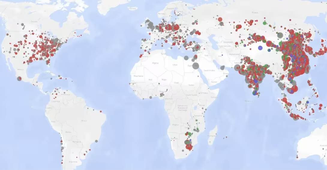
Methane emissions from the coal, oil, and gas sectors remain a critical challenge to global climate targets. Despite peaking demand for fossil fuels, the continued buildout of extraction infrastructure, such as proposed oil and gas fields coming online before 2030, threatens to undermine progress under the Global Methane Pledge. These potential emissions significantly outpace the figures reported by many operators participating in the U.N.’s flagship watchdog agency, the Oil and Gas Methane Partnership 2.0. As the only free and public database providing estimates for gas pipelines and Liquid Natural Gas (LNG) terminals worldwide, these data allow for the identification of high-emission assets, such as the Incheon LNG Terminal in South Korea and the Texas Eastern Transmission Gas Pipeline in the United States.
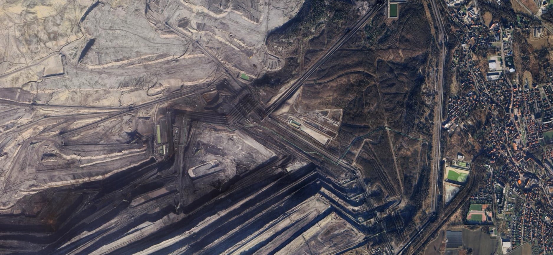
In the coal sector, GEM’s data products illustrate the infrastructure and operators responsible for methane output across the globe as well as their mitigation efforts. Estimates for over 5,000 mines show that proposed projects could emit over 15.7 million tonnes annually. Analysis of every high resolution, publicly available remotely-sensed methane plume near coal mines as of mid-2025 has successfully associated over half of these events with specific in-mine infrastructure elements.
By combining these findings with companion datasets on coal mine boundaries and mitigation projects, it is now possible to track how mine operators manage gassy ventilation shafts and degasification stations. This asset-level transparency provides the essential evidence needed to drive attribution and mitigation efforts across the fossil fuel lifecycle.
China accounts for 80% of methane emissions tied to proposed coal mines globally
The three operators leading the global oil and gas field buildout have not submitted emissions data to the UN’s watchdog agency.

Methodology
The methodology for the Global Methane Emitters Tracker describes how data is collected, categorized, and organized.
The Global Methane Emitters Tracker includes 1) annual methane emissions estimates from fossil fuel assets using emission factors applied to GEM’s infrastructure datasets and 2) infrastructure attribution information for publicly available, remotely-sensed methane plumes. In addition, GMET research team maintains a companion sheet of coal mine methane mitigation projects across the globe built off the Global Methane Initiative’s global project list.
The annual methane estimates for different infrastructure types as well as the plume-by-plume attribution information can be found in the downloadable database. Additionally, each infrastructure asset and individual methane plume has a profile on GEM.wiki. Infrastructure assets with methane plumes associated with them have a section on their individual wiki pages with details about the relevant plumes. The GMET tracker database is updated annually. The coal mine methane companion sheet can be downloaded alongside the main GMET dataset, and is also linked in the Global Coal Mine Tracker.
Global Methane Emitters Tracker uses data in Global Energy Monitor’s Global Coal Mine Tracker, Global Oil and Gas Extraction Tracker, and Global Gas Infrastructure Tracker for both annual methane emissions estimates and for plume attributions.
Individual asset annual estimates
The infrastructure data on coal mine, oil and gas sites, pipelines, and LNG terminals are collected from and validated through five main sources:
- Government data on individual units, country energy and resource plans, and government websites tracking extraction permits and applications.
- Reports by state-owned and private companies;
- News and media reports;
- Local non-governmental organizations tracking extraction permits and operations;
- On-the-ground contacts who can provide first-hand information about a project.
A detailed methodology can be found on the Global Methane Emitters Tracker methodology page on GEM.wiki. Broadly, annual emissions estimates are developed using a “bottom-up” emissions factor based approach. For coal mine emissions estimates, GEM calculates coal mine methane emissions based on coal production, coal methane content at given mine depth, and an emissions factor coefficient. For pipelines, GEM utilizes a Tier 1 IPCC methodology. For oil and gas reserves, GEM has developed an in-house adaptation of the Oil Climate Index + Gas methodology developed by the Rocky Mountain Institute. For oil and gas production, GEM has linked assets from GEM’s Oil & Gas Extraction Tracker to the 2022 methane emissions estimates developed by Climate TRACE. These alignments are not necessarily one to one; each GEM asset may only be responsible for a portion of the emissions listed in the TRACE database.
Methane plume attribution information
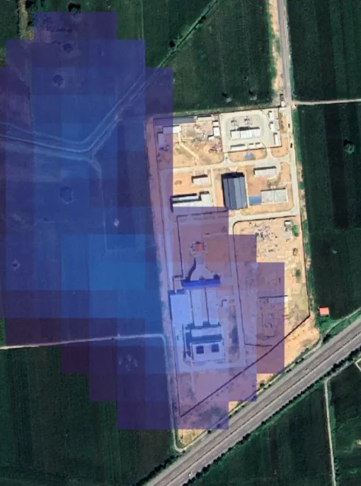
GEM creates infrastructure attribution information for a subset of all publicly available remotely sensed methane plumes. The plume data are provided by CarbonMapper and theInternational Methane Emissions Observatory. GEM’s process for creating attribution information involves visually comparing the locations of the origins of plumes as reported by the plume data provider to Google Earth imagery of fossil fuel infrastructure assets and GEM’s own location and operational data. See the FAQ and summary tables for coverage details, and the detailed methodology page on GEM.wiki for more information.
For each remotely-sensed methane plume observation, a wiki page is created on Global Energy Monitor’s GEM.wiki. Wiki pages for infrastructure assets in other trackers which have plumes associated with them also contain the relevant plume information. Wiki pages provide a repository for in-depth information. Under standard wiki convention, all information is linked to a published reference.
To allow easy public access to the results, Global Energy Monitor worked with Earth Genome to develop a map-based and table-based interface of GEM data. In the case of exact coordinates, locations have been visually determined using Google Maps, Google Earth, and Planet Labs or an authoritative source such as a government dataset. For proposed projects, exact locations, if available, are from permit applications or other company documentation. If the location of a unit or proposal is not known, GEM identifies the most approximate location, often the center of the country/area.
Frequently asked questions
GEM provides attribution information for plume imagery created through publicly- and philanthropically-funded satellites and plane-based imagers which have been transformed into methane plume data products delivered by CarbonMapper and the International Methane Emissions Observatory.
A summary of the number of plumes analyzed by region and date is available in the summary tables for the tracker. For the December 2025 update, GMET researchers analyzed every point-source methane plume detected by all public satellite imagers within the known or probable boundary of coal mines within GEM’s databases as of August 15, 2025 (the earliest detection date of a plume analyzed in this fashion is July 31st 2020.)
These data are in addition to the historic methane plume data available in GMET as of its September 2024 update including:
- All CarbonMapper global methane plumes which are located within 10.5 km of a GEM coal mine, bioenergy plant, oil or gas plant, hydropower plant, coal plant, coal mine, or LNG terminal which were observed by the NASA EMIT satellite as of March 29th, 2024.
- All observations taken by May 14th, 2023 from the plane-based AVIRIS-NG and Global Airborne Observatory instruments in Louisiana and the Western Gulf, New Mexico, Pennsylvania, and Texas (non-Permian).
- Plume observations made between 2020-2022 in California through the plane-based imagers
GEM’s workflows for producing plume attribution data have evolved iteratively. As of the September 2024 update, GEM’s historic plume data update had focused on CarbonMapper’s methane observations which had not been publicly attributed in published academic literature (e.g. California plumes analyzed by Rafiq et al., 2020) or by high-profile civil society efforts (e.g. the Environmental Defense Fund’s PermianMAP project.)
In broad terms, no. As of the December 2025 update, the emissions estimates provided in the infrastructure tabs are largely based on “bottom-up” approaches where emissions factors are multiplied against relevant activity factors (e.g. LNG gas throughput, pipeline length, etc.)
The oil and gas production data are linked to an external emissions model published by Climate TRACE. This model does integrate some remotely sensed methane data. However this data comes from area imagers which are used to estimate emissions across a larger swath of land, not the high-resolution sensors used to track emissions to specific pieces of equipment, which is what GEM uses for creating attribution information. Additionally, each oil and gas extraction area listed in GMET does not necessarily have a 1 to 1 relationship with its associated asset in the Climate TRACE database. See the GMET methodology page on GEM.wiki for details.
The oil and gas production data should be interpreted along the lines of: “this particular GEM oil and gas extraction asset is within a larger oil and gas field which Climate TRACE has shown to emit X amount of methane annually”
Stochastic processes, i.e. difficult-to-predict large emissions events, contribute greatly to annual methane emissions from oil and gas fields. This is especially true at scales as granular as GEM’s oil and gas field data. Estimates that do not take this into account greatly understate the impact of methane emissions from these assets. The Global Methane Emissions Tracker is in iterative development; rather than minimize the magnitude of methane emissions from these assets, the research team is exploring alternative estimation approaches.
Please fill out an error report here.
The following people contributed to research: Sara Fatimah, Claire Pitre, Charmaine Dalisay, Jeanette Lim, Mingxin Zhang, Ryan Driskell Tate, Dorothy Lan Mei, Wynn Feng, Dominic Nicholas, and Saul Lerman Sinkoff. The project manager is Saul Lerman Sinkoff.
Contact
For questions about the Global Methane Emitters Tracker, contact Saul Lerman-Sinkoff: