pipelines tracked
km of combined pipeline length
LNG terminal projects
tonnes of total LNG capacity
Overview
A global expansion of midstream gas and LNG infrastructure is being driven by exporters, such as the United States, and gas-consuming regions, including Asia and Europe.
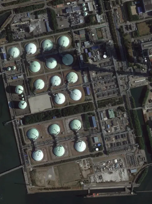
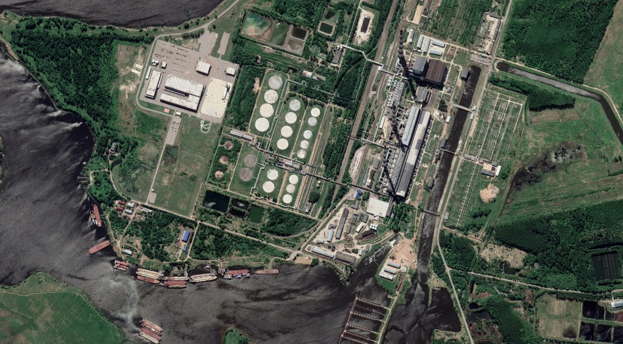
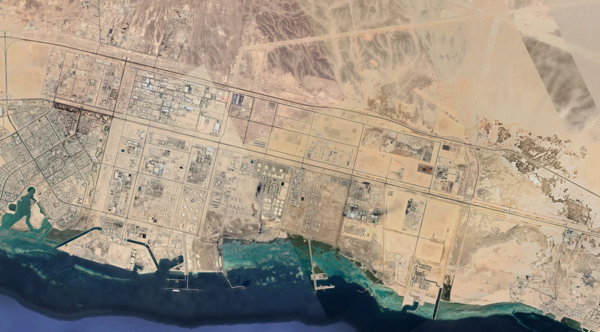
Midstream gas infrastructure — pipelines, terminals, and liquefied natural gas (LNG) carriers — forms the backbone of regional and global gas networks, connecting extraction sites with downstream end users. LNG enables gas delivery anywhere with a regasification terminal and has driven recent expansion, despite comprising only 13% of gas consumed globally. Gas exporting countries are building infrastructure to monetize reserves, while importing countries cite growing energy demand in power, industrial, and heating sectors; energy security concerns; and perceptions of gas as a "transition fuel," despite LNG having emissions on the same order as coal.
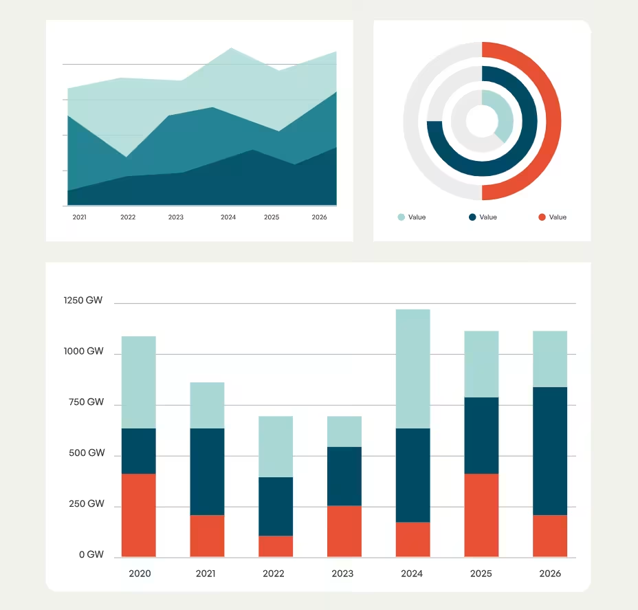
China, Russia, and India collectively account for nearly half of the approximately 206,000 km of gas pipelines in development across the world. There is enough proposed LNG export capacity planned globally to triple existing operating capacity, led by the United States, Russia, and Mexico. Regionally, Asia and Europe are developing 85% of prospective LNG import capacity, concentrated in China, India, Germany, and the United Kingdom. LNG carriers are built almost exclusively in South Korea and China, and the global fleet is set to expand by at least 35% based on current orders.
Despite the scale of midstream gas infrastructure in planning, LNG remains economically risky. Expensive LNG terminals, gas pipelines, and LNG carriers could be underutilized or become stranded assets if enough gas demand does not materialize, especially since LNG is frequently uncompetitive against alternative energy sources like renewable power and coal.
The contiguous United States first exported LNG in 2016, and since then, it has become the world’s largest exporter, with one-fifth of global operating export capacity.
The length of gas pipelines proposed and under construction could circle the earth over five times.
What's inside?
Methodology
Global Energy Monitor’s Global Gas Infrastructure Tracker (GGIT) uses a two-level system for organizing information, consisting of both a database and wiki pages with further information. The database tracks individual project phases and includes information such as project owner, status, and location. A wiki page for each project is created within the Global Energy Monitor wiki. The database and wiki pages are updated annually.
GGIT includes natural gas transmission pipelines and liquefied natural gas (LNG) import and export terminals. Distribution and gathering pipelines are not included. Historically, a capacity threshold was used for pipeline inclusion, but GGIT now aims to comprehensively track all transmission pipelines longer than 100 km that transport natural gas. We also attempt to track shorter pipelines, especially those that are newly proposed or under construction. No capacity threshold is used for LNG terminals. GGIT only tracks terminals that import or export LNG, and not those used solely for LNG storage or bunkering.
Proposed: A company or government has proposed a project.
Construction: Site preparation or major construction activities have begun.
Shelved: Two years have passed with no development on a proposed project, or it has been announced as shelved. This status is also used for projects that have not begun operations over two years after construction was completed.
Cancelled: Four years have passed with no development on a proposed project, or cancellation has been announced, or the project once appeared in company documents and is no longer in them.
Operating: The project has been formally commissioned; commercial operation has begun.
Idle: The project was at one time operational and now sits unused, but has not been formally mothballed.
Mothballed: The project has been formally taken offline, but not yet decommissioned.
Retired: The project has been decommissioned.
Pipeline and LNG terminal data are collected from and validated through five main sources:
- Government data on individual projects, country energy and resource plans/documents, and government websites tracking project permits and applications
- Reports by state-owned and private power companies
- News and media reports
- Local non-governmental organizations tracking pipelines or terminals, or their permitting process
- On-the-ground contacts who can provide first-hand information about a project
For each project, a wiki page is created on Global Energy Monitor’s GEM.wiki. Wiki pages provide a repository for in-depth information including project background, financing, environmental impacts, public opposition, and routes. Under standard wiki convention, all information is linked to a published reference, such as a news article, company or government report, or a regulatory permit. In order to ensure data integrity in the open-access wiki environment, Global Energy Monitor researchers review all edits of project wiki pages.
If a terminal is in development and not built, the location is estimated based on knowledge of its proposed location or project maps found in research. If it is an expansion of an existing terminal, it is given the same location as the original project. If the terminal is under construction or operating, we attempt to find its exact location based on satellite imagery or documentation. Terminal locations are labeled “approximate” or “exact”.
Pipeline routes are generated by tracing images of route maps when found in the public domain using QGIS. If no map visual can be found, the route is approximated based on the written information (start and end points, and potential midpoints).
In some cases a route may be missing and the pipeline is absent from the map, but it is still tracked in the database.
As of May 2022, route mapping is prioritized in this way:
- For pipelines longer than 100 km in length, we attempt to have a medium- or high-resolution route. We prioritize pipelines that are proposed, under construction, and operating. If we are unable to find a route map to trace in GIS software, we approximate it, typically with a straight line or a curve with a few intermediate points.
- For pipelines whose lengths are not available from research, we attempt to include at least a low-resolution route in the database and Wiki page, so that we can approximate the pipeline’s length using this route.
- For projects less than 100 km in length, we prioritize mapping routes that have easily available routes online (via maps or shapefiles).
At the regional and country level, GEM estimates total capital expenditures for LNG terminals and for gas pipelines. These estimates combine project costs identified in media, company websites, and other sources with estimates using regional averages derived from GEM data. For more information, see the methodology page for GGIT cost estimates.
LNG Carrier Tracker
Inclusion criteria
The LNG Carrier Tracker focuses on conventional LNG carriers that are specifically involved in transporting or regasifying LNG (including Floating Storage and Regasification Units, or FSRUs) in global LNG trade.
It does not include Floating Storage Units (FSUs), which are LNG carriers that have been converted to permanent floating storage at terminals. It also does not track small-scale and mid-scale LNG carriers (involved in short-haul delivery), LNG bunkering vessels, or domestic-only ships. Vessels that were cancelled or decommissioned prior to December 2025 are not included in the tracker.
Research process
The LNG Carrier Tracker relies entirely on publicly-accessible data. The foundation for the data set is the International Gas Union (IGU) World LNG Report, released annually, which catalogues active and on-order LNG carriers. GEM and SFOC build upon this list by adding vessels, updated statuses, and other data derived from industry news and publicly available contracts, which are integrated into the Tracker along with any new IGU data on a quarterly basis. The first release of this Tracker was in December 2025.
Status categories
Proposed: A new vessel has been announced by a shipping company or a charterer, and there are public sources to support this. However, a binding contract with a shipyard has not been signed, and financing may not be finalized. These ships are included in the IGU orderbook, and extra research is done to determine whether a contract has been signed between a ship owner and a shipyard.
On order: A vessel has a binding shipbuilding contract between a ship owner and a shipyard. This typically includes a signed contract, a delivery year, and a hull number in the shipyard.
Active: An LNG carrier has been built and delivered and is operable. The majority of these ships are operational, but some may not be sailing, whether idle, under repair, or another reason. We do not distinguish among these substatuses; all are considered technically active.
Frequently asked questions
As of 2022, the Global Fossil Infrastructure Tracker (GFIT) has been split into two separate trackers for oil and gas. The Global Gas Infrastructure Tracker (GGIT) tracks gas transmission pipelines and liquefied natural gas (LNG) terminals. The Global Oil Infrastructure Tracker (GOIT) tracks crude oil and natural gas liquids (NGL) pipelines here.
Accuracy varies, and we are constantly working to improve our pipeline routes. Historically, we have prioritized mapping pipeline routes that are 100 km or longer, though we are now in the process of adding smaller routes where time allows.
If the route you see is a straight or low-resolution line on the map, it is likely approximated from start and end points (and sometimes midpoints). If it has more curvature, we have either obtained the route from official sources, or we have traced it from an image using GIS software. If you have any suggestions for route improvements, or questions on a specific project, please let us know via the “Improving the tracker” contact info below.
Accuracy for terminal location also varies. We use a combination of GIS mapping and research to identify an accurate location. We mark location accuracy as “approximate” or “exact” based on our confidence through this research.
Yes. Gas pipeline and LNG terminal data are now provided as Excel files and in GeoJSON, GeoPackage, and shapefile formats via the download form.
We aim to track all operating natural gas transmission pipelines, though in some cases and countries we may not have comprehensive coverage. Prior to May 2022, we focused primarily on pipelines longer than 100 km, and we still prioritize these projects but are continually filling in gaps we have for smaller projects. If you are searching for a pipeline that is not on the map, we may still track it in our full database, which includes pipelines without routes, available at the “Download Data” link.
We aim to track all under-construction, proposed, and shelved oil and NGL transmission pipelines, though in some cases and countries we may not have comprehensive coverage. Prior to May 2022, we focused primarily on pipelines longer than 100 km. Currently, we attempt to track any in-development transmission pipeline, regardless of size. If you are searching for a pipeline that is not on the map, we may still track it in our full database, which includes pipelines without routes, available at the “Download Data” link.
We aim to track all gas transmission pipelines with these statuses, but we historically have prioritized pipelines that are either operating or in development.
Note, as of May 2022, we are increasing coverage of gas pipelines with these statuses, but we have historically only focused on those that are in development, and those will be the most comprehensively covered.
Yes, we aim to track all LNG import or export terminals globally, regardless of status. GGIT does not track terminals used solely for storage or bunkering.
We’d love to hear from you! Please fill out a report form here.
The tracker was designed and produced by Global Energy Monitor, an organization developing collaborative resources on the global energy system. Researchers who have contributed to GGIT include Nagwa Abdallah, Greig Aitken, Sophia Bauer, James Browning, Natalie Cherot, Gregor Clark, Norah Elmagraby, Hanna Fralikhina, Joshua Frank, Christina Haidar, Christine Juta, Erik Hazard, Mason Inman, Ben Inskeep, Christine Juta, Zhanaiym Kozyboy, Ahna Kruciz, Baird Langenbrunner, Isabel Mahon, Ted Nace, Dan O’Beirne, Lydia Plante, Aiqun Qu, Rob Rozansky, Christine Shearer, Janna Smith, Aiganym Valikhanova, Adrian Wilson, and Scott Zimmerman.
Please fill out an error report here.
Please refer to the Download Data section for citation guidance.
Contact
For questions about the Global Gas Infrastructure Tracker, contact Baird Langenbrunner: