countries included
active extraction areas
areas under development
oil and gas discoveries
Overview
New oil and gas production activity is lower than previous decades but remains out of line with global climate goals.
Scenarios compatible with limiting warming to 1.5°C show that oil and gas demand can be met without developing any new fields, and emissions from existing oil and gas projects push well past remaining carbon budgets for that target. Yet, major producing countries are doubling down to maintain current production levels, while new countries are also looking to extract oil and gas, betting on high carbon futures or risking stranded assets.
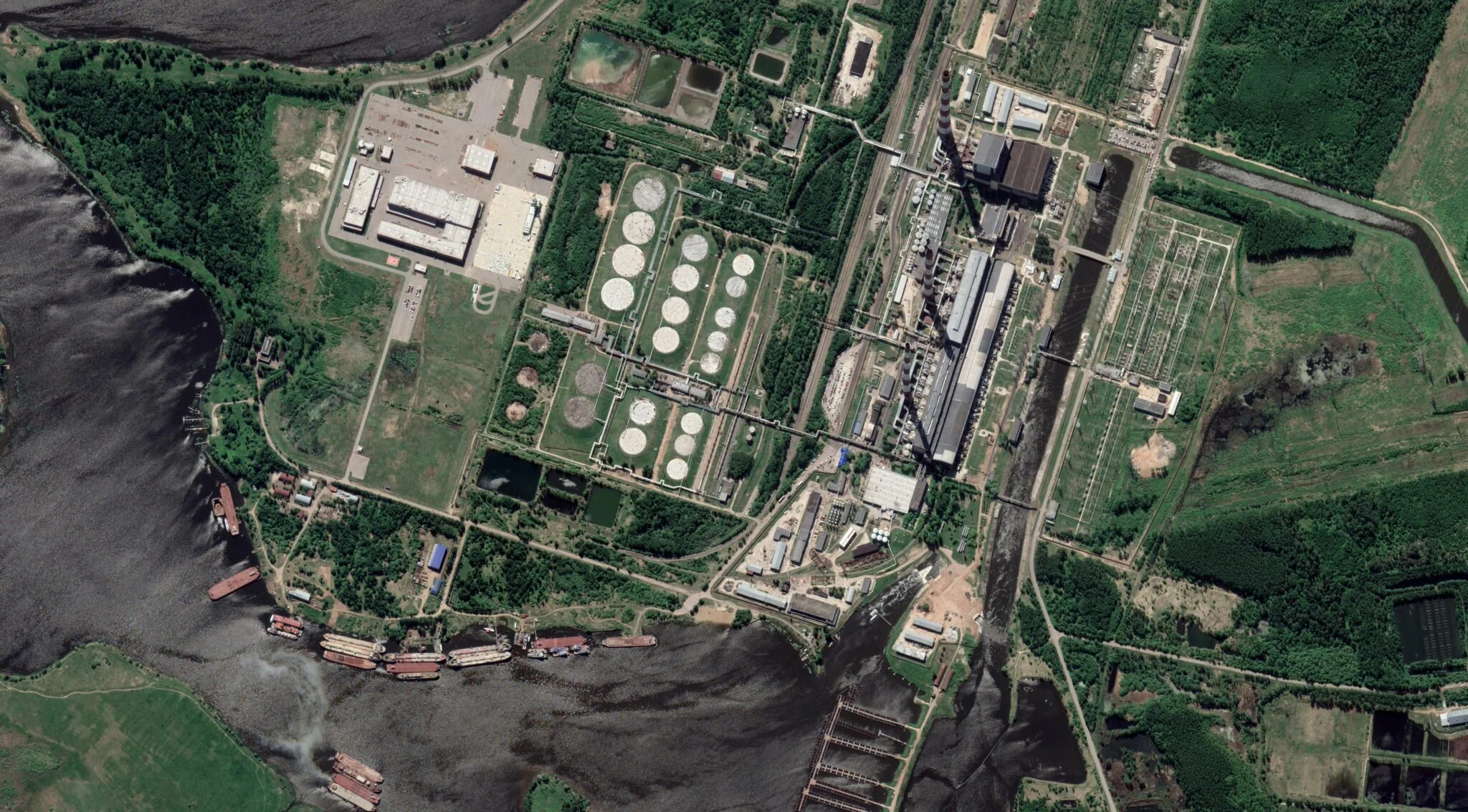
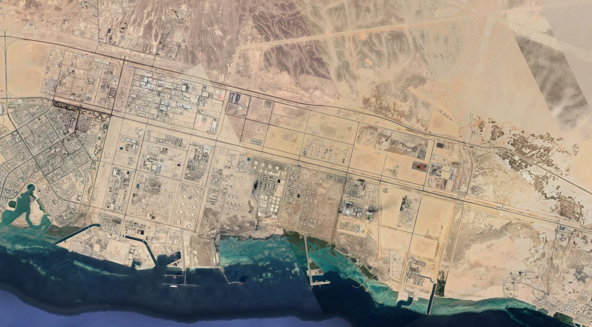
As many of the easiest basins for extraction have been thoroughly developed, companies and countries are turning to riskier projects to maintain their production and offset maturing fields. Offshore drilling is becoming more prevalent, more complicated reservoirs are being tapped, and production in frontier regions with large infrastructure costs is being targeted. Lead times for new conventional projects are getting longer, indicating that converting resources into supply has become materially more complex and slower.
Five producers — the United States, Russia, Iran, Canada, Saudi Arabia, and China — produce nearly 60% of the world's oil and gas. These five countries are exploring for new projects in order to maintain their status as top producers. The Oil Majors (ExxonMobil, Shell, Chevron, TotalEnergies, bp, and ConocoPhillips) are exploiting new hydrocarbon resources in countries that historically have not produced much or any oil and gas, potentially creating new petrostates financially invested in the continued use of oil and gas.
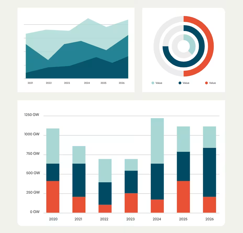
Business as usual production requires annual discoveries of about 16 billion barrels of oil equivalent (boe), according to the International Energy Agency. In 2025, 7 billion boe were discovered, 45% of the discovery volumes called for. Discoveries were in the same range as 2025 throughout the 2020s. The result is structural misalignment: Supply plans are inconsistent with climate goals, yet discovery trends are insufficient to sustain flat production over the long term.
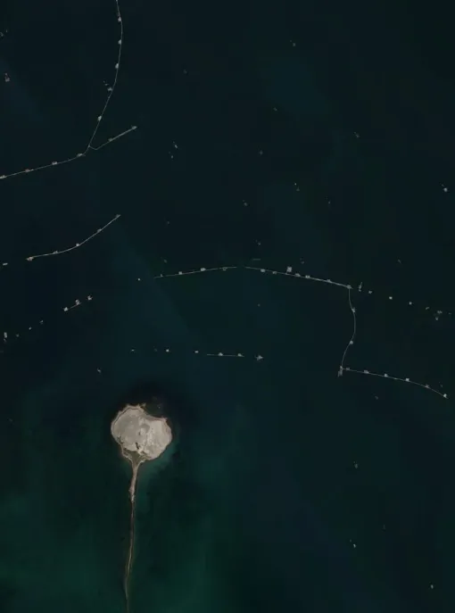
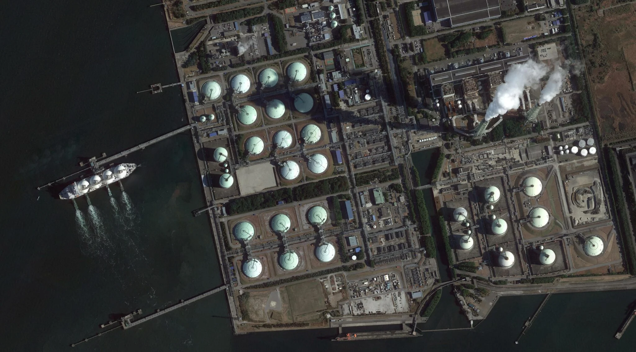
Offshore development now accounts for 29% of global production, with recent projects predominantly offshore.
Russia, Norway, Nigeria, Australia, and the United States hold 34% of pre-production fields.
Methodology
GOGET uses a two-level system for organizing information, consisting of both a database and wiki pages with further information. The database tracks individual oil and gas units and includes operator and ownership structure, unit status, fuel type, production levels, reserves, and location. A wiki page created for each oil and gas unit in GEM.wiki contains further detail as well as references for the data.
This data set includes only units that have production of 1 million boe/yr or more and/or reserves of 25 million boe, or those that were included in previous iterations of GOGET.
GOGET is based on public sources, data are only included if they are publicly accessible.
Discovered: A field is typically considered to be discovered when there has been a well drilled into a particular formation, and it yielded some significant quantity of oil and/or gas. Discovered fields are not necessarily economic to exploit.
- Early: Year when a discovery was first announced.
- Advanced: Year when noticeable steps toward development status are taking place, such as engineering studies and a Final Investment Decision (FID) is anticipated soon after.
In Development: Following discovery, the unit is in the process of moving toward commercial production.
- Planned: The year an FID is expected to occur.
- Actual: The year a positive FID is announced.
Operating: The field has commercial production of oil/gas (that is, quantities that are being sold to market).
- Planned: An anticipated date of first production.
- Ramp up: The year of first 1-3 years of production, as production levels increase toward anticipated peak production levels.
- Plateau: The year in which production reaches peak anticipated plateau levels.
- Decline: Production starts to decrease from plateau level.
Abandoned: Operations have ceased, but the wells/field were not decommissioned following all the usual steps, such as plugging the wells (including filling the well with cement).
- Assumed: A non-corporate actor states that the project is in all likelihood abandoned.
- Stated: A company involved states that the project has been left without proper cleanup, or a lawsuit is decided alleging that a company abandoned their duties.
For a full listing of status categories and definitions, please see the Global Gas and Oil Extraction Tracker Methodology on GEM.wiki
Oil and gas unit data are collected from and validated through five main sources:
- Government data on individual units, country energy and resource plans, and government websites tracking extraction permits and applications.
- Reports by state-owned and private companies;
- News and media reports;
- Local non-governmental organizations tracking extraction permits and operations;
- On-the-ground contacts who can provide first-hand information about a project.
For examples of data sources used, please see the Global Gas and Oil Extraction Tracker Methodology on GEM.wiki
For each oil and gas unit, a wiki page is created on Global Energy Monitor’s GEM.wiki. Wiki pages provide a repository for in-depth information including project background, financing, environmental impacts, fuel types, public opposition, coordinates, and maps. Under standard wiki convention, all information is linked to a published reference, such as a news article, company or government report, or a regulatory permit. In order to ensure data integrity in the open-access wiki environment, Global Energy Monitor researchers review all edits of project wiki pages.
To allow easy public access to the results, Global Energy Monitor worked with Earth Genome to develop a map-based and table-based interface. In the case of exact coordinates, coordinates have been obtained from an authoritative source such as a government data set. For proposed projects, exact locations, if available, are from permit applications or other company or government documentation. If the location of a unit is not known, GEM attempts to identify an approximate location. If no location data are available, the area on the global tracker map is shown at the center of the country/area and labeled as “Country Level Only” as “Location Accuracy.”
If an outline of the field is available, GEM aims to incorporate that data into GOGET. Raster maps are georeferenced and traced using QGIS. Field outlines in a geospatial format from authoritative sources are also cleaned and implemented at WKT files. Coordinates represent the centroids of the fields, not a platform or well.
Frequently asked questions
The colors indicate the status category:
- Operating: The unit has commercial production of oil/gas (that is, quantities that are being sold to market).
- In development: Following discovery, the process of moving toward commercial production has begun. This means that a company is planning to develop the project, as evidenced by one or more of the following criteria being reached: the company has applied for approval for commercial production (if needed in the jurisdiction), the project has reached the Final Investment Decision (FID), a final environmental impact statement has been published, and/or the drilling of development (not appraisal) wells and/or adding takeaway capacity (infrastructure such as pipelines, storage tanks, etc.) to enable commercial production has begun.
- Discovered: A unit is typically considered to be discovered when there has been a well drilled into a particular formation, and it yielded some significant quantity of oil and/or gas. Discovered units are not necessarily economic to exploit.
- Mothballed: Operations temporarily shut down; may be restarted.
Each unit location is marked “exact” or “approximate.” In the case of exact coordinates, locations are either specifically identified on a mapping service such as Google Maps, Open Street Maps, etc., or gathered from company or government documentation. If the location of a unit is not known, Global Energy Monitor identifies the most accurate location possible based on available information.
To find out the coordinates of a location and whether a location is exact or approximate, click on the location dot, select “More Info”, and look under “Project Details.”
GOGET only includes publicly available data on extraction sites which produce more than 1 million boe/y and/or have reserves greater than 25 million boe or were previously included in iterations of the data set. Data on areas below that threshold, and areas where publicly available data are not available, are not included.
GOGET relies on the government or company providing information to define the unit being described. In most cases, this unit is defined as a “field.” However, there are other possibilities. Data are sometimes reported at the well, asset, or project level., “Asset” is commonly used for unconventional production where unique field name and operator combinations were deemed an “Asset” and entered into GOGET. A project is a grouping of “fields” or “assets”.
There are many definitions of reserves (meaning, how much oil and gas a field has to extract). Proved reserves (aka 1P) are the most commonly reported category, particularly for financial evaluations of companies. But for understanding the long-term potential for oil/gas extraction, broader categories are more useful, in particular 2P (proved and probable) reserves. However, companies and countries define and report reserves differently. GOGET provides the reserves data and classifications as reported by the original sources.
Please fill out an error report here.
The tracker was designed and produced by Global Energy Monitor. To the greatest extent possible, the information in the tracker has been verified by researchers familiar with particular countries. The following Global Energy Monitor researchers participated in the January 2024 update: Jelena Babajeva, Lucy Hummer, Jeanette Lim, Claire Pitre, Mingxin Zhang, and Xing Zhang. The following people participated in the initial plant-by-plant research: Elena Bixel (Europe Beyond Coal), James Browning (Global Energy Monitor), Bob Burton (Global Energy Monitor), Gregor Clark (Global Energy Monitor), Joshua Frank (formerly Global Energy Monitor), Ted Nace (Global Energy Monitor), Christine Shearer (formerly Global Energy Monitor), Adrian Wilson (Global Energy Monitor), Aiqun Yu (Global Energy Monitor), and others. Additional wiki editing and fact checking was provided by Christine Law, Iris Shearer, Austin Woerner, Yvette Zhu, and others. The tracker’s initial architect was Ted Nace and its first project manager was Christine Shearer. The current project manager is Flora Champenois. Web/GIS programming was done by Tom Allnutt and Gregor Allensworth (GreenInfo Network), with support from Tim Sinnott (GreenInfo Network).
Contact
For questions about the Global Oil and Gas Extraction Tracker, contact Scott Zimmerman: